NZDR North Island, 2022 Ride Resources
For all riders - these resources will prove essential for you when you're planning your ride. We recommend paying particular attention to the specifically prescribed route, and making every effort to follow the route precisely.
If you can, it is worth avoiding simple point-to-point navigation between checkpoints as you might well be taken 'off-the-prescribed-route' and along more significant / major roads. We have provided downloadable TRACKS within the GPX files on this page, along with GoogleMap links which can be used within your own efforts to create a planned and navigable route along the prescribed route.
If you are not sure how best to do this, then reach out and ask one of your fellow riders, or the general Long Distance Rider community online - on our Facebook group, or ask one of the organisers.
We have created a fully descriptive set of ONLINE content on this page, along with a downloadable GPX format collection of the items which you see in the maps below.
You can, and should download these files if you have *any* type of GPS based navigation. These can be used within GPS devices, both Garmin and TomTom devices can import GPX content to them (sometimes via the cloud, other times via planning software).
Smartphones can use GPX files in apps, such as Rever. They can be imported into GoogleMaps, and can be referenced on the ride by importing them into one of your own Google My Maps collections. There are many more apps which can use the content which we've provided for you here. - If you're unsure, ask someone for help.
So, kick back and work through each and every part of what we've provided for your ride on this page. There are two main sections, the NI1600 is listed first, the NI800 is listed next.
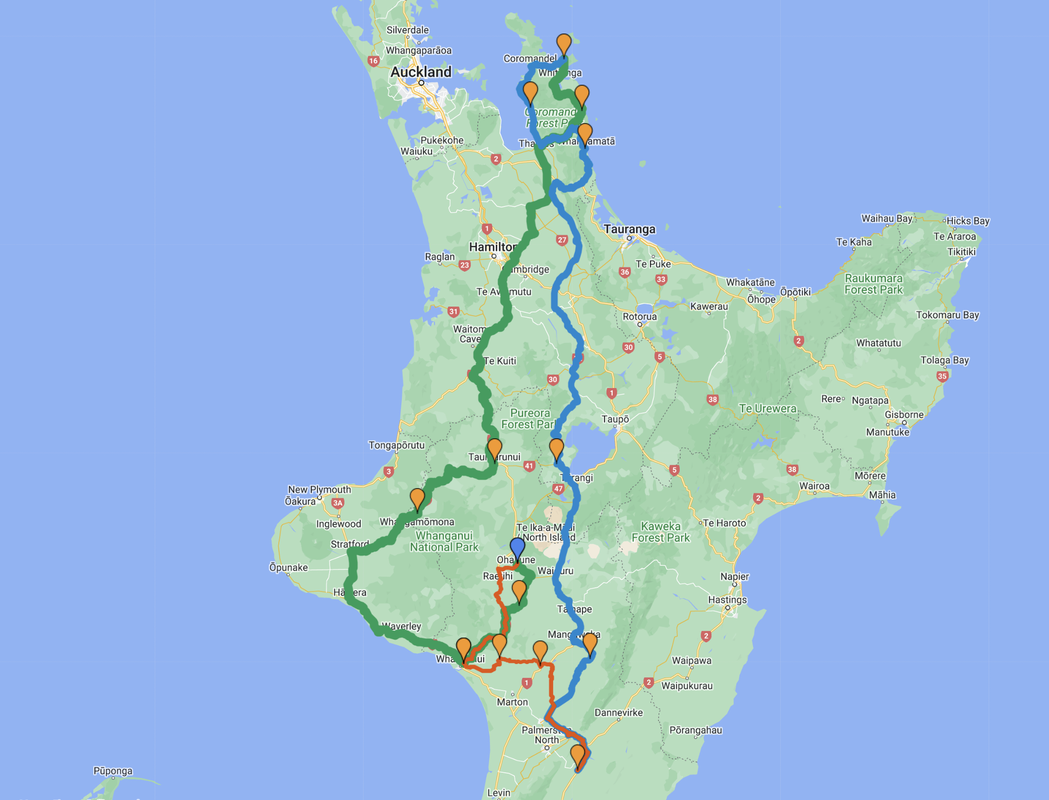
NORTH ISLAND 1600 - 8-9th October 2022
SpotWalla - All 1600 riders are strongly encouraged to use SpotWalla to log their ride please. There is a SpotWalla Location page for you to join. The URL you need to join the location page is: CLICK HERE - Join password is nzdr2216 - If you're unsure what this is all about, please ask for help on the Facebook group and someone there is sure to provide you with some assistance.
For more information please see: https://www.distanceriders.org.nz/2022-spotwalla-pages.html
For more information please see: https://www.distanceriders.org.nz/2022-spotwalla-pages.html
Link to Ride PDFs (ALL ARE IMPORTANT):
| 2022_ni800___ni1600_briefing.pdf |
| 2022_ni1600_ride_instructions__f_.pdf |
| 2022_ni1600_checkpoints__f_.pdf |
Link to Google Map: www.google.com/maps/d/u/3/viewer?hl=en&mid=1G6kShHQqHJngl_BBlQVDCdhoa60eSDA&ll=-38.62236818238658%2C175.0944972038269&z=8
Link to GPS -GPX file for NI1600:
Link to GPS -GPX file for NI1600:
| nzdr_ni1600_2022_-_final.gpx |
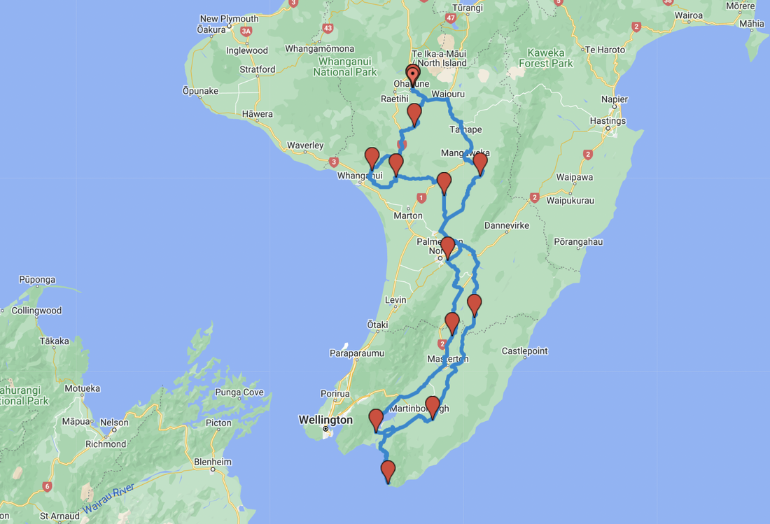
NORTH ISLAND 800 - 8th October 2022
Link to NI800 Ride PDFs (ALL ARE IMPORTANT):
| 2022_ni800___ni1600_briefing.pdf |
| 2022_ni800_ride_instructions__f_.pdf |
| 2022_ni800_checkpoints__f_.pdf |
SpotWalla - All 800 riders are welcome to use SpotWalla to log their ride please. There is a SpotWalla Location page for you to join. The URL you need to join the location page is: CLICK HERE - Join password is nzdr228 - If you're unsure what this is all about, please ask for help on the Facebook group and someone there is sure to provide you with some assistance.
For more information please see: https://www.distanceriders.org.nz/2022-spotwalla-pages.html
For more information please see: https://www.distanceriders.org.nz/2022-spotwalla-pages.html
Link to Google Map: www.google.com/maps/d/u/3/viewer?mid=1O2EnzPJ5bBCZNsEx6YSoRfe3Xip0_h4&ll=-40.504768710341466%2C175.5059266090393&z=9
Link to GPS - GPX file for NI800:
Link to GPS - GPX file for NI800:
| ni800_2022.gpx |